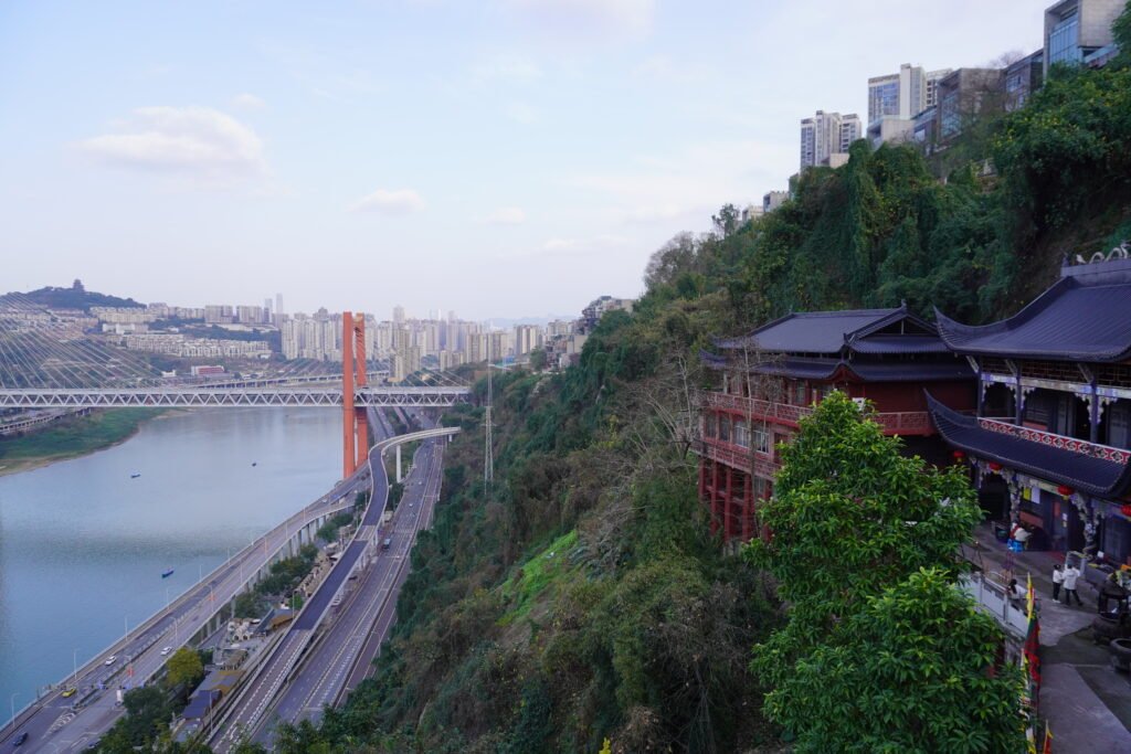
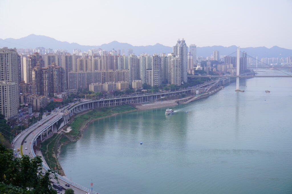
Chongqing stands as one of the most dramatic cases of adapting urban space to rugged topography. Known worldwide as a “mountain city,” it rises from steep ridges at the confluence of the Yangtze and Jialing rivers. Unlike the flat-grid capitals of northern China, Chongqing demonstrates how urban planning can negotiate cliffs, rivers, fog, and density at the same time.
From a military stronghold guarding the Sichuan Basin to a modern megacity with multilayered transport systems, Chongqing reflects both historical continuity and bold architectural invention.
Ancient Chongqing, A Fortress on The Rock
Gateway to the Sichuan Basin
Ancient Chongqing originated as a strategic fortress rather than a commercial metropolis. Situated at the narrow entrance to the Sichuan Basin along the Yangtze River, it controlled the water passage linking central China with the fertile inland plain. Whoever held this rocky peninsula could regulate military access and river trade.
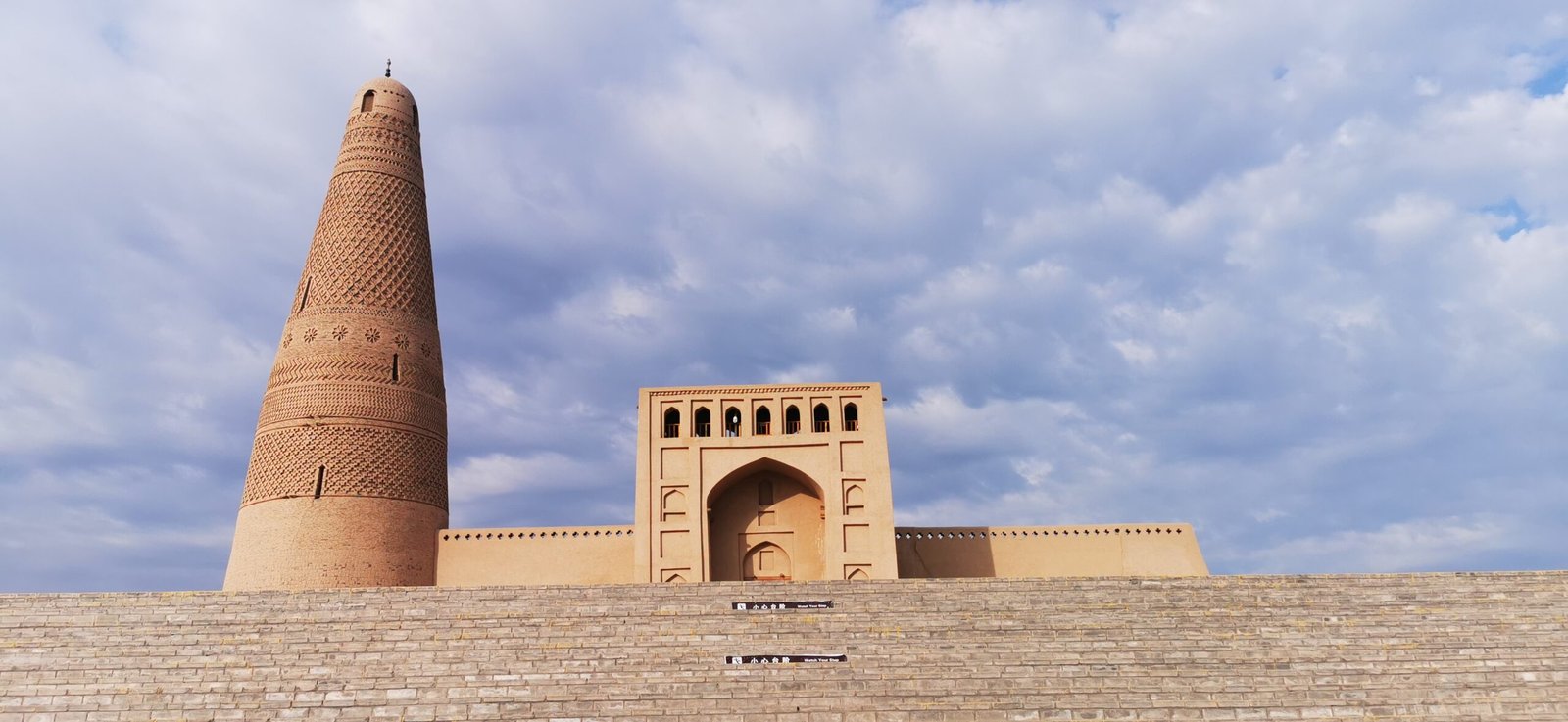
During the Southern Song period, the area became famous for its defensive system, including the stronghold at Diaoyu Fortress. Mongol forces struggled for decades to penetrate this mountainous barrier. The natural cliffs, combined with city walls that followed the ridgeline, formed a three-dimensional fortification system.
Unlike cities such as Xi’an or Beijing, which developed on flat plains with orthogonal street grids, Chongqing relied on elevation differences. Planners carved stairways into slopes and aligned streets along contour lines. Defense and geography shaped its early urban planning logic.
Topography as Defense Strategy
The peninsula between two rivers created natural moats. Steep escarpments discouraged invasion while allowing visual surveillance of river traffic. Architecture responded directly to the terrain: houses stepped down the hillsides; gates opened toward docks; watchtowers crowned the highest ridges.
This early spatial organization established a pattern that continues today. The mountain determined circulation routes, building orientation, and social hierarchy. In that sense, Chongqing offers a living case study of how landscape governs architectural form — a theme also explored in our article on Chinese city walls at archinatour.com.
Chongqing Was Reshaped into A Civic City Nowadays
From Fortress to Municipality
In the 20th and 21st centuries, Chongqing transformed from a regional stronghold into one of China’s four direct-controlled municipalities. The city now functions as an economic, industrial, and cultural hub for western China.
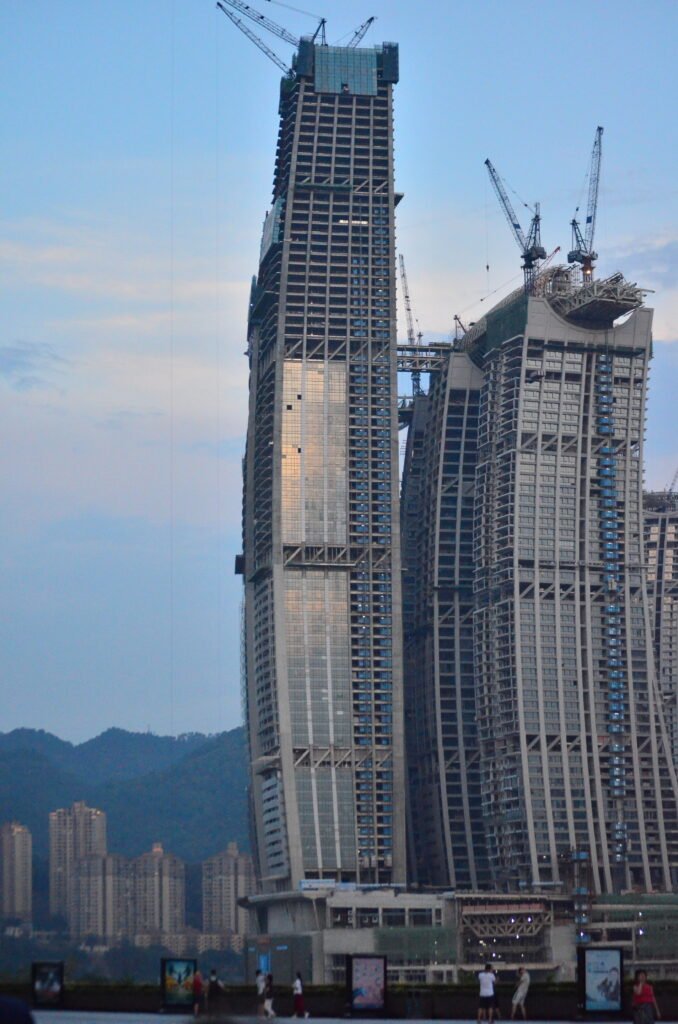
Modern urban planning shifted focus from defense to connectivity, public service, and high-density housing. Skyscrapers rise along the riverbanks, and financial districts replace old dockyards. Developments such as Raffles City redefine the skyline while preserving the dramatic mountain backdrop.
Civic Life in a Vertical City
Today’s mountain city serves more than 30 million residents across its municipality. Public life unfolds in layers:
- Elevated roads cross valleys.
- Light-rail lines run both underground and above ground.
- Pedestrian stairways connect platforms at different heights.
- River cableways supplement bridges.
Unlike flat megacities, Chongqing’s civic experience unfolds vertically. Residents move up and down as frequently as they move horizontally. This verticality shapes everyday routines, commercial patterns, and public spaces.
The shift from fortress to civic city reflects broader changes in Chinese urban development, similar in transformation scale to cities like Shanghai, yet far more constrained by geography.
Spatial Conflict Between Chongqing’s New Role and Old Infrastructure
The rapid expansion of Chongqing created tension between historical fabric and contemporary demands. The ancient street network, originally designed for pedestrians and porters, cannot easily accommodate automobiles or large-scale logistics.
Density Versus Terrain
Population growth intensifies land use on already limited flat surfaces. Planners must balance preservation with redevelopment. Old neighborhoods cling to slopes where construction equipment struggles to operate. Infrastructure upgrades require terraced foundations and complex retaining structures.
Transportation Challenges
Bridges and tunnels multiply every decade, yet traffic congestion persists. Unlike cities that can expand radially across plains, the mountain city must carve corridors through rock or span wide rivers.
The old defensive logic—compact and inward-looking—conflicts with modern expectations of openness and accessibility. Consequently, urban planning in Chongqing requires constant negotiation between terrain, heritage, and modernization.
Spectacular Constructure Resolving Chongqing’s Geographic Limitations
Multilayered Transport Systems
To overcome topographical constraints, Chongqing developed spectacular engineering solutions. The Liziba light-rail station famously passes through a residential building, demonstrating how infrastructure integrates with existing urban fabric.
Massive bridges span both the Yangtze and Jialing rivers. Multi-level interchanges stack roadways above one another. These structures convert steep gradients into usable platforms.
Architectural Adaptation
Traditional stilt houses once addressed uneven slopes. Modern high-rise towers now perform a similar adaptation at larger scales. Engineers design deep pile foundations to anchor buildings into bedrock. Terraced podiums create artificial flatlands for commercial use.
These strategies reflect a broader principle found throughout Chinese architectural history: builders adapt structure to site conditions. Readers interested in timber structural logic may compare this approach with our discussions on mortise-and-tenon construction and traditional roof systems at archinatour.com.
Redefining Urban Planning in a Mountain City
Rather than flattening the terrain, planners embrace complexity. Elevation differences become assets for scenic viewpoints and layered skylines. Night illumination enhances the dramatic topography, reinforcing Chongqing’s identity as a vertical metropolis.
The city thus demonstrates how urban planning can convert geographic limitation into visual and functional advantage.
Conclusions
Chongqing offers a compelling narrative of continuity and transformation. It began as a rocky fortress guarding the entrance to the Sichuan Basin. Its defensive layout followed mountain ridges and river cliffs. Over centuries, the city evolved into a modern municipality that supports dense population, commerce, and transportation networks.
The tension between ancient structure and modern demand creates spatial conflict, yet it also stimulates innovation. Through bridges, tunnels, multilayered rail systems, and adaptive architecture, the mountain city overcomes its hilly terrain without erasing it.
For architects and planners, Chongqing serves as a powerful example of extreme terrain utilization. It shows that geography does not merely constrain development; it defines identity. Effective urban planning does not fight the mountain—it collaborates with it.
As China continues to urbanize inland regions, Chongqing stands as a living laboratory where history, topography, and modern engineering converge.